

South Holston River Map: Best Wade and Float Access Points
The South Holston River near Bristol and Bluff City, Tennessee, is one of the most respected tailwaters in the Southeast for fly fishing. Cold, clear water from the South Holston Dam creates ideal conditions for healthy populations of brown and rainbow trout, drawing anglers from across the region. Knowing where and how to access the river safely is one of the most important parts of a successful day on the water. This guide breaks down the best public wade and float access points along the South Holston River, with insights into parking areas, water levels, and what to expect at each location. Whether you are planning your first trip or looking to explore new stretches, this overview will help you navigate the river with confidence and make the most of your time in East Tennessee.
Understanding the South Holston Tailwater
How the Tailwater Flows Shape Fishing Access
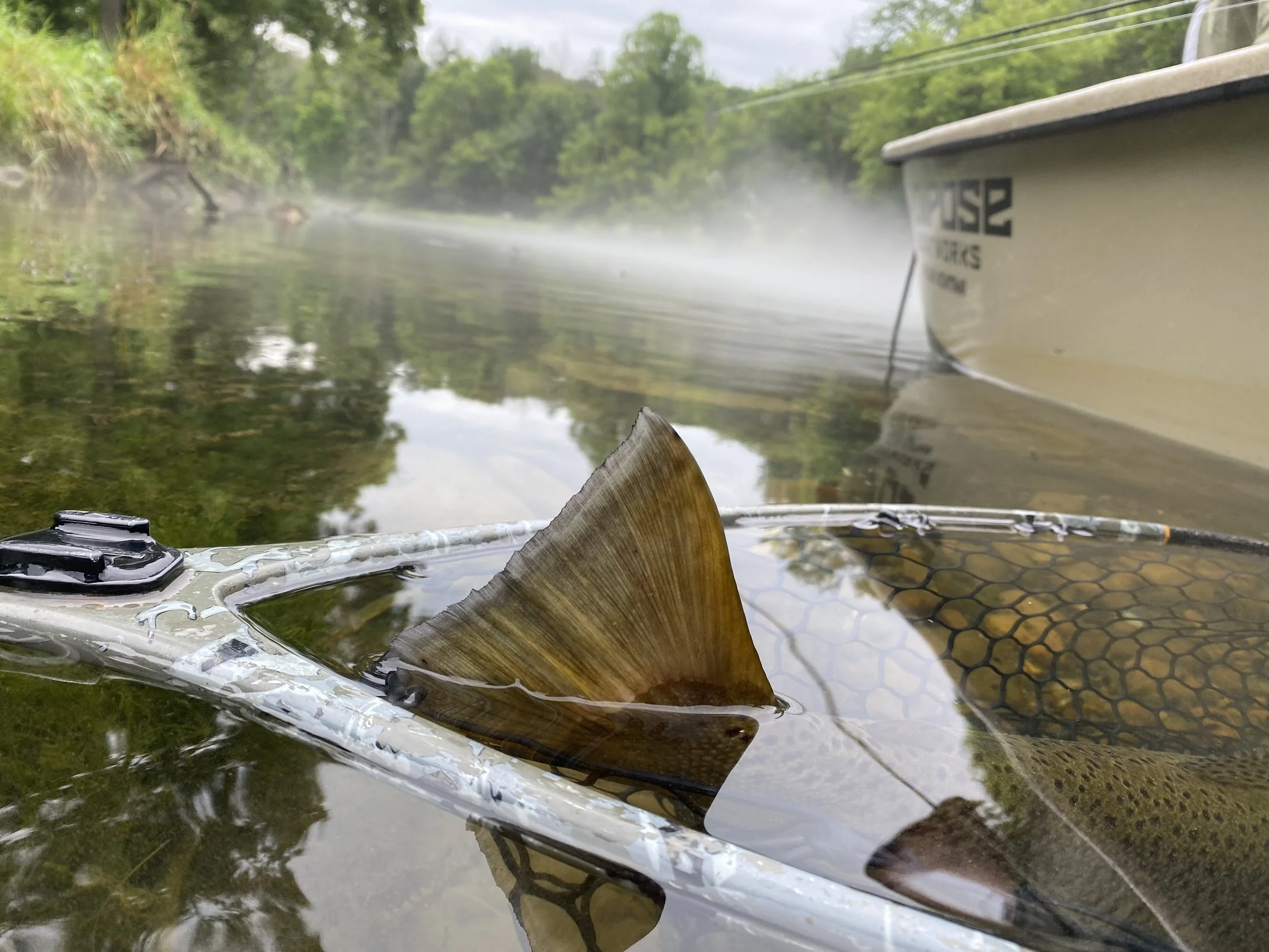
The South Holston River begins below the South Holston Dam, where cold water releases from the bottom of the reservoir create a consistent tailwater fishery. This steady temperature and oxygen-rich flow support one of the healthiest trout populations in the Southeast. Because the dam regulates water levels, anglers experience a range of conditions throughout the day depending on generation schedules.
At low flow, large stretches of the river open up for wading. When the Tennessee Valley Authority (TVA) begins generating power, the river rises quickly, shifting from calm runs to swift current ideal for float fishing. Knowing how to read generation patterns helps anglers plan where to fish and when it is safe to enter or exit the water.
Here are a few key things to know about the tailwater:
TVA generation schedule: Always check flow forecasts before heading out.
Wade vs. float access: Low flow favors wading; high flow allows for longer float trips.
Temperature stability: Cold releases from the dam create ideal trout habitat year-round.
These conditions make the South Holston River both a technical and rewarding fishery. Understanding how the tailwater behaves is the foundation for choosing the right access points and making the most of each section of water.
Best Wade Fishing Access Points on the South Holston River
Weir Dam Access (Below South Holston Dam)
The Weir Dam area is the most popular and productive wading location on the South Holston River. Located directly below the dam, this stretch provides consistent cold water and steady insect activity throughout much of the year. There is a paved parking lot, restrooms, and well-marked trails that make access easy for anglers of all experience levels. During low water, anglers can move between riffles, seams, and slower runs with relative safety. It is important to keep an eye on generation schedules since the water level rises quickly once the dam starts releasing.
Osceola Island and Recreation Area
Just downstream from the dam, the Osceola Island Recreation Area offers a mix of gentle wading terrain and walking trails that make it a family-friendly option. This section provides reliable access to several productive runs, especially during low flow conditions. Anglers can follow the island trail to reach side channels and slower water, which often hold rising trout during sulphur hatches. With ample parking and maintained trails, Osceola Island is one of the most accessible areas for those new to South Holston fly fishing.
Big Springs Road Access
The Big Springs Road access is a great option for anglers looking to escape the crowds at the dam. This section features a blend of pocket water, deeper pools, and shaded banks that fish well during summer months. Parking is limited, so arriving early is recommended. The gravel road leads to a small pull-off area, and a short trail provides entry to several wadeable stretches. When the water is low, anglers can cross to mid-river gravel bars for better casting angles and deeper drifts.
Bluff City Access (Above Bluff City Bridge)
Bluff City offers convenient public access in the lower portion of the tailwater, close to the bridge and local amenities. This stretch fishes best during low to moderate flows and provides a variety of water types, including long riffles and deep pools. It is a favorite among locals during the sulphur hatch in late spring and early summer. Parking is available near the bridge, and anglers can walk both upstream and downstream for plenty of open water. Bluff City access provides an easy way to explore the lower river while staying close to Bristol and nearby lodging or dining options.
Best Float Access Points for Drift Boats and Rafts
South Holston Dam to Bluff City (Full-Day Float)
The stretch from South Holston Dam to Bluff City is the most well-known and frequently floated section of the river. This route offers around eight to ten miles of diverse water, including deep runs, long riffles, and several productive seams that hold quality brown and rainbow trout. Anglers typically put in at the base of the dam, where a concrete ramp allows for easy boat launching. The take-out is located near Bluff City, offering convenient parking and smooth access for trailers. This float fishes best during steady generation when water levels remain high enough to navigate comfortably.
While this float provides excellent opportunities to cover a wide range of habitat, anglers should always monitor TVA generation schedules and be prepared for sudden changes in flow. Experienced rowers will find this section manageable, but beginners may benefit from joining a guided trip to learn the safest routes and best fishing zones.

Bluff City to Boone Lake (Half-Day Float Option)
The lower section from Bluff City to Boone Lake provides a quieter and more relaxed float with less fishing pressure. This stretch typically covers around five to six miles and is best suited for half-day trips or late-afternoon floats. The take-out is located near the upper end of Boone Lake, and depending on the lake level, boaters can access several small ramps or public pull-outs.
The water here is slower and deeper than the upper section, which makes it a good choice during higher generation periods or when anglers want to focus on streamer fishing. The lower river holds a mix of trout and smallmouth, especially as it transitions closer to the lake. Because the current can slow significantly near the take-out, it is wise to plan extra time for rowing. This float offers a peaceful alternative to the busy upper sections and still provides plenty of productive water for fly anglers.

Planning Your Day on the South Holston
Checking TVA Generation and Flow Levels
Because the South Holston is a tailwater fishery, the flow is entirely controlled by the Tennessee Valley Authority (TVA). Understanding how and when the dam releases water is the most important part of planning a safe and productive day. During non-generation periods, the river is calm and perfect for wading. Once power generation begins, the water rises quickly and becomes unsafe for anyone on foot. Float anglers, on the other hand, depend on these higher flows for easier navigation.
Before heading out, check the TVA’s Lake Info App, call the South Holston Dam generation hotline, or visit the TVA website for current schedules. Remember that posted times are estimates and can change due to power demands. Here are a few simple guidelines to keep in mind:
0 turbines (low flow): Best for wade fishing.
1 turbine: Float fishing becomes possible.
2 turbines: Full flow, best left to experienced boaters.
Monitoring these patterns of the South Holston Generation Schedule not only improves safety but also helps anglers plan which access points will be most productive at different times of day.
Parking, Regulations, and Respecting Private Property
Public access along the South Holston River is generous, but much of the surrounding land is privately owned. Being mindful of boundaries helps preserve the positive relationship between landowners and the fishing community. Use designated parking areas whenever possible and avoid blocking roads or driveways. The Tennessee Wildlife Resources Agency (TWRA) posts clear signs around legal access points, so pay attention to posted restrictions.
A few quick reminders when planning your trip:
Pack out all trash and leave each site cleaner than you found it.
Avoid walking across agricultural fields or private lawns to reach the river.
Review local fishing regulations, including size limits and catch-and-release guidelines.
Planning ahead with flow information, parking details, and respect for private property will ensure a smooth, safe, and enjoyable day on the South Holston River.
Pro Tips from Local Guides
When to Fish Each Section
Local guides know that timing is everything on the South Holston River. Water releases, insect hatches, and light conditions all play a role in determining when and where to fish. The upper section near the Weir Dam is most productive during low flows when trout feed on emerging midges and sulphurs. As flows increase, many anglers move downstream to float the river toward Bluff City, where fish often hold tight to structure and deeper channels.
Seasonal patterns also influence where to spend your time.
Spring: Prime sulphur hatches begin in late April and continue through early summer.
Summer: Morning and evening hours are best when water temperatures remain cool.
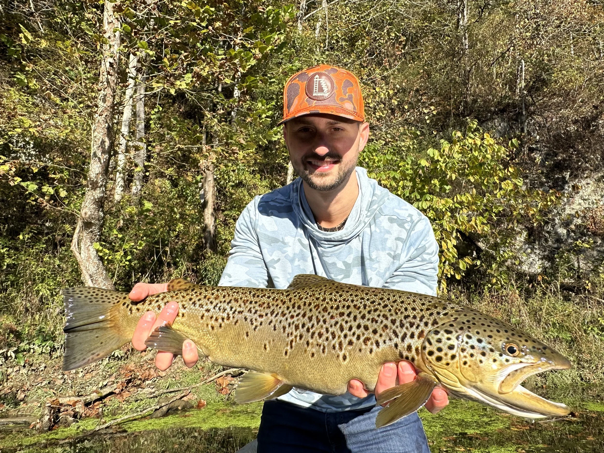
Fall: Brown trout become more active before the spawn, offering excellent streamer fishing.
Winter: Focus on slower pools and use small midges and nymphs.
Matching your location and timing to the river’s natural rhythms can turn an average day into a memorable one.
Recommended Gear and Tactics
Fishing the South Holston requires preparation and an understanding of how to adapt to changing conditions. Lightweight waders and felt or rubber-soled boots help maintain traction on the slick limestone bottom. A 9-foot, 5-weight rod is versatile for most conditions, though some anglers prefer a 4-weight for delicate dry fly presentations.
Local guides often carry two rods rigged differently—one with a dry fly setup and another for nymphing or streamer fishing—to stay ready as hatches or flows change. The following patterns are proven local favorites:
Dry flies: Sulphur duns, BWOs, and small midges.
Nymphs: Pheasant tails, zebra midges, and split-case BWO nymphs.
Streamers: Olive or black woolly buggers during higher water.
Whether wading or floating, staying flexible with tactics and closely observing the water can make a big difference. Experienced guides emphasize reading current seams, adjusting weight for depth, and using natural drifts to connect with the river’s selective trout.
Frequently Asked Questions
What are the best public access points for fly fishing on the South Holston River?
Some of the top public access points for wade and float fishing include Weir Dam (directly below the South Holston Dam), Osceola Island Recreation Area, Big Springs Road / Emmett Bridge, and Bluff City (above the Bluff City Bridge). Each access spot offers different habitat types—riffles, deeper runs, shaded banks—so your ideal choice depends on water level and fishing style. Arriving early and checking parking availability is advisable, especially at the more popular sites.
When is the best time to wade fish the South Holston River?
Wade fishing is most effective during low to moderate flow periods when the water is calm and safe to walk. When TVA begins generation, water levels rise quickly and currents strengthen, making many wade zones unsafe. Always check the current dam release schedule and time your trip to avoid hazardous conditions.
How do I check the TVA generation schedule for the South Holston River?
You can view the latest generation schedule by using the TVA Lake Info app, contacting the South Holston Dam generation hotline (800-238-2264), or checking online via TVA’s official website. These schedules provide projected turbine use and expected flow times, though they may change based on demand. Treat the posted times as estimates and remain alert on the water for sudden changes.
Can I float the South Holston River year round?
Floating is possible when flows are high enough to support boat navigation, which often corresponds with active dam generation periods. During low flow periods, many shallow stretches become impassable for drift boats or rafts, making floating less practical. Always verify flow conditions and plan put-in and take-out points based on current water levels.
Do I need a Tennessee fishing license and trout permit for the South Holston?
Yes, if you fish on the Tennessee side of the South Holston, you must carry a valid Tennessee fishing license and a trout permit, both of which can be purchased via the Tennessee Wildlife Resources Agency (TWRA). Be sure to check for any specific trout regulations—such as slot limits, fly-only zones, or catch & release rules—in effect for that river section. Failing to comply can result in fines or penalties.
What fly patterns are effective on the South Holston River?
During the prolific hatches, sulphur duns, blue-winged olives, and midges are top choices for dry fly fishing. For subsurface tactics, nymphs such as pheasant tail, zebra midge, and split-case BWO are reliable options. In higher flows or post-spawn periods, olive or black woolly buggers and streamer patterns often trigger strikes from larger trout.
Explore the South Holston with Appalachian Outdoors
The South Holston River offers some of the best trout fishing in the Southeast, and knowing how to approach its access points can make all the difference. From the well-known Weir Dam to the quieter stretches near Bluff City, each section of the river has its own rhythm, hazards, and ideal conditions. For anglers new to the area or those looking to sharpen their understanding of the tailwater, fishing with a local guide can dramatically shorten the learning curve.
Appalachian Outdoors specializes in guided wade and float trips on the South Holston River, helping anglers safely navigate changing flows while focusing on productive water. With experienced guides who know the river’s subtle shifts, you can learn how to read current seams, adjust to TVA generation, and match your approach to each section’s conditions. Whether you are a beginner learning to cast or an experienced fly fisher looking to refine your technique, a guided day on the water provides valuable instruction and insight.
Booking a guided trip also allows you to focus on the experience without worrying about logistics. Appalachian Outdoors provides high-quality gear, local transportation, and real-time knowledge of which stretches are fishing best. Each trip is customized to the angler’s goals, ensuring a safe and rewarding experience from start to finish.
Plan your next South Holston River adventure with Appalachian Outdoors. Discover how local expertise, professional instruction, and a deep respect for the water can help you fish smarter and enjoy every moment on one of Tennessee’s finest tailwaters.